Sunday 30 July 2023

Roley pool. Mt Dale lookout and Forrestdale lake Nature reserve

 Earlier on during the week I had planned a drive visiting Roley Pool,  Mt Dale Lookout and a few other stops for my day off unfortunately the weather was not great and it rain most of the trip my First stop was at Roley Pool the walk trail was an easy one around 2.5kms a real nice walk lots of Granite Boulders , picnic area Boardwalks  and plenty of water flowing 


Was supposed to go to Thompsons Roley pool, Boulder rock and Christmas tree Well but it rained most of the trip and I probably spent a little too much time at Roley Pool. The next stop was at the Mt Dale lookout the road ther was wet, muddy and plenty of pot holes on the way so it was a slow drive after arriving I took some Photos from the lookout and went for a short walk around the trail. There is an animal hide that I wanted to check out, but it started to rain again so I headed back to the car for the trip home. 


On the way home I made a quick detour to have a look at Forrestdale Lake Nature Reserve wher I had grown up want to plan a future trip there when weather gets better, as the lake drys up for the year the waders and other birds and wildlife are usually around.


All Images are Copyright Mark. A. Gray

Wednesday 26 July 2023

Exploring Canning Mills and the Back of Martin

 Today was a different type of trip for me I had been searching on Google Earth for locations of Granite Outcrops, and also searching for Abandoned Mines or Quarries to photograph, today was probably not the best day as it had rained most of the day, I found a track on google maps that would take me to to locations I wanted to look at and headed down Mills rd east to find the track, after turning on the track I followed the maps until I got there the track was quite rocky, sandy in some places, muddy and wet not suitable for a 2WD Vehicle, I have an AWD forester which handled it pretty good. When I arrived at my destination it poured down with rain and I never got out to go looking for the Abandoned Mines or the Granite Outcrop which wer roughly in the same area, I decided to try another route home as it was quite a rough track, after using google maps unaware at the time, it took me to the Powerlines Track which as way worse than the track I just took, the Powerlines track is rocky, muddy, ruts, creek crossings steep descents and climbs you name it a 4WDrivers dream, after folowing the track for a while I had just gotten down the the bottom of a steep descent, I was starting to think that I was never going to get out of there stoppping mulitple times to check the track up ahead and was considering turning around and going back the way I come. When I got to the bottom of the hill the rain had stopped so I got out and took a couple snaps. The photos don't do it justice on how steep the descent was sliding down a few times in the mud
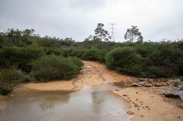


  Deciding that I was closer to the exit of the track and a long way off the original starting point  I took on the challenge of the Powerlines track with only 3 or 4kms until Mills rd exit and probably around 12km or so from when I started, I kept going along the powerline track only locking it in sports mode 1st gear once for a steep muddy climb as I approached the top there was just lots of reasonably large rocks and ruts, eventually getting back on to Mills rd East but not without a final challenge of a few reasonably sized ruts of flowing water to cross. On the way home I was just thnking how well the Forester handled the powerlines with no damage and I didn't bottom out or get stuck once, it was a fun but challenging drive for me as I was on my own and haven't done much offroad driving like that, I did a quick Detour to Forrestdale Lake on the way home to check out how much water is in the lake and to see if it was worth going there for photos one day as I grew up in the area and used to have a lot of fun around the lake.

All Images are copyright Mark A. Gray
Thursday 13 July 2023

A short stroll at Thompsons Lake Nature reserve

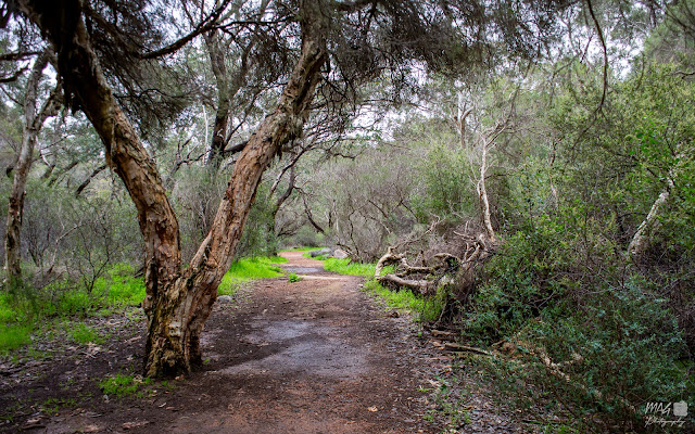
 Today I decided to go for a look around Thompson Lake Nature Reserve there is a 6.4km walk trail around it , there are also several entry points around the Nature Reserve. Today I went the the Russell rd car park and went for a wander around that area, it was reasonably late in the afternoon so I didn't go very far about 3.5km there and back I have been here on several ocassions sometimes on foot or for a ride on my bike but it is always a nice place to go for a walk although in the colder wet months a part of the trail is under water so the best time to go would be probably be in the spring, in the summer you are  likely to encounter snakes around the reserve. All year round there is usually birds and Kangaroos, wildflowers, in the spring as the lake starts to dry up for the year the waders are usually found in the shallows or in the mud.

Here is a few snaps from this trip


All images are Copyright Mark A. Gray


Read more about Thompsons Lake on Wikipedia

https://en.wikipedia.org/wiki/Thomsons_Lake


Read about the trail on Alltrails 

https://goo.gl/maps/Z8EQRziAbky42vWi9


Daytrip to West Dale, Brookton, York on the hunt for Canola Fields and Wildflowers

      Today My Karen and I both had days off from work so we decided to do a trip to go and look for wildflowers and have a look at the Cano...